 LOCAL FIT KUMANOBack to list
Daimonzaka Questions Are Easier to Sort by "Walking Direction"
When you look into Daimonzaka, several questions tend to come up: parking, bus stops, how long it takes, how many steps there are, and how tough it is. In fact, almost all of these line up neatly once you decide which side of the slope you'll start walking from.
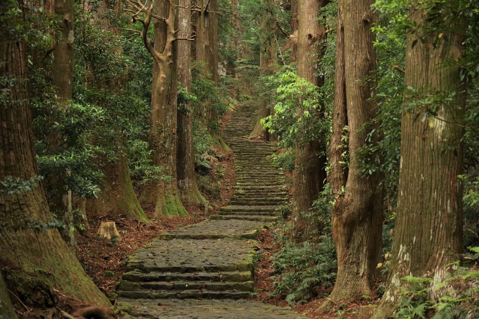
Daimonzaka is part of the pilgrimage route on the Kumano Kodo heading toward Nachisan. You walk about 600 meters uphill along a moss-covered stone-paved path through a grove of towering cedars. Both the lower entrance and the upper exit have their own ways to get there, so first map out those access points in your head.
Getting to the Lower Entrance: Bus Stops and Parking
The Daimonzaka Bus Stop Is Right at the Entrance
If you come by local bus, get off at the "Daimonzaka" stop near the entrance and you can step straight onto the stone path. However, service frequency and connections vary by season. Especially if you're coming on a day trip, check the latest timetable before you set out.
Parking Is on the Entrance Side
If you're driving, the basic option is to use the parking area near the entrance of the slope. Fees, number of spaces, and operating hours may change, so we won't list specifics here—please check the official information.
One thing to keep in mind: if you park at the entrance, you'll need to return to the same spot at the end. Will you walk back down the slope after reaching the top, or come down by bus? If you're traveling with others, deciding this split in advance will make things smoother.
Treat Walking Time and Step Counts as "Rough Guides"
Figure on 30–40 Minutes Going Up
Walking from the bottom to the top, 30 to 40 minutes is often cited as a reasonable estimate, including stops for photos. You'll likely linger at the Meoto-sugi (married cedars) and the Tafuke-oji shrine, so give yourself plenty of buffer.
Step Counts Vary by Source
The stone steps are often said to number "267," but explanations differ depending on where the counting begins. Take the figure as a rough reference, and picture the path as alternating stretches of steady steps and gentler stone paving—that will match the real experience more closely.
The Real Challenge Isn't the Climb—It's the Footing
Whether Daimonzaka feels tough depends greatly on the person. The slope itself isn't especially long, but the stone pavement can be slippery after rain or when covered with fallen leaves, and the descent can be hard on the knees.
- Walking up from the bottom: You'll get out of breath more easily, but you can take your time checking your footing as you go.
- Walking down from the top: Physically easier, but watch out for the strain on your knees and the risk of slipping.
Whichever direction you choose, the best precaution is to wear comfortable shoes with solid soles. Don't rush—a pace that lets you take in the cedar roots and mossy stones is just right.
How to Plan When You're Unsure
1. If you want a proper walk: Start from the Daimonzaka bus stop or the entrance-side parking, walk up, and continue on to the Nachisan shrines.
2. If you're worried about your legs: Reach the upper area by other means and only experience part of the slope on the way down.
3. If you're splitting up with your group: The walkers go up while the drivers meet them at the top.
It's a short slope, but it packs the atmosphere of the ancient road into a tight stretch. As long as you've sorted out the bus schedule and your return plan in advance, the rest is just enjoying the sound of your footsteps on the stone.
*Specific details such as fees, timetables, and parking capacity are subject to change. Always confirm with official sources before you set out.
For the full picture of getting to the Nachi area by car or bus, see our complete Nachi Falls access guide.
Image: 熊野古道中辺路 大門坂 (via (公社)和歌山県観光連盟)